
Seilaplan 
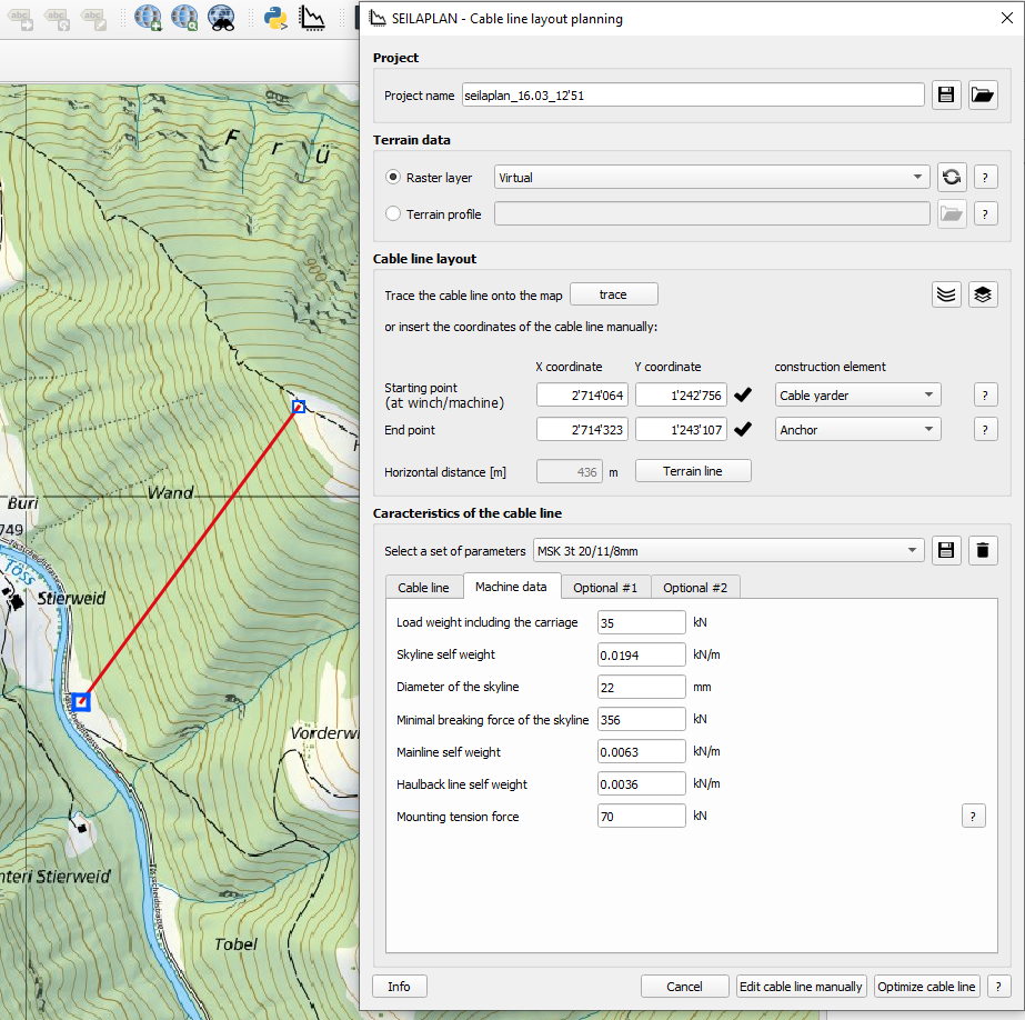
The QGIS plugin Seilaplan is a GIS-based tool to support forest management for the design and optimization of cable road layouts. It was developed in 2012 as part of Dr. Leo Bont's dissertation at ETH Zurich and has been further developed by him at the Swiss Federal Institute for Forest, Snow and Landscape Research WSL since 2017.
The abbreviation "Seilaplan" stands for Seilkran Layout Planer. Using defined start and end coordinates, machine data and other technical cabl line parameters, the tool calculates the optimum cable road layout based on a digital elevation model. The position and height of the supports as well as the most important characteristic values of the rope line are determined. The load path curve is calculated using Zweifel's algorithm (1960), a chain line method. In the research project "New foundations for efficient cable road planning" completed in 2020 by the Sustainable Forestry Research Group (WSL) under the direction of Dr. Leo Bont, calculations of the load path curves according to Zweifel (1960) achieved significantly more accurate results than with the widely used method of Pestal (1961).